Wednesday, June 26, 2013

Lightning Safety Awareness Week!

I'm sure you have heard this before... When you hear or see lightning, seek shelter immediately. Lightning is not something to mess around with. One strike of lightning has enough power to run a light bulb for a year. And on top of how much power it generates form one strike, lightning is 50,000 degrees Fahrenheit!  

I'll give you a small lesson on lightning. It all starts with a Cumulonimbus cloud (Thunderstorm cloud) has different charges within the cloud. There are protons or a positive charge at the top of the cloud. And there is electrons or a negative charge at the bottom of the cloud. Then the ground is mostly positively charged. The opposite charges within the cloud and on the ground creates lightning. This lightning will actually pass through a channel that was made through the air multiple times. Which is why you see multiple flashes of light sometimes. Lightning also looks for the shortest distance to the opposite charge which is why tall buildings and trees are struck by lightning more often then something lower to the ground.


Photo/ Info From:
nws.gov
britannica.com
theatlantic.com 
Wednesday, June 19, 2013

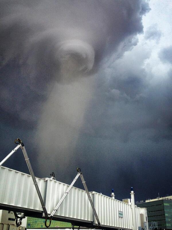
Wacky Weather: Tornado in Denver

Airplanes weren't the only things to touched down at the Denver International Airport yesterday. An EF-1 tornado made its own flight plan to land at the airport as well. The tornado did directly hit some weather instruments at the airport, and luckily were not damaged. However, the instruments did record a gust of 97mph. No one was injured and no major damaged reported during this event.
View image on Twitter

Photo From/ Info From:
wunderground.com
7News Denver

Tuesday, June 18, 2013

Forecasting 101: Derechos

Some of you might have heard last week the meteorologists call the approaching storms Derechos. I figure that most of you have never heard this word in your life before, so I thought I would break it down for you.

A Derecho is a strong straight line wind event common associated with a "Bow Echo" or a line of thunderstorms. Now when I say strong winds, I am talking upwards of 100 mph gust. In last weeks derecho event there was a report of 91 mph gust in Fort Wayne, Indiana, and a report of 81 mph gust in Tuckerton, New Jersey. Last week's derecho was a "Super Derecho" Event, because of the widespread area that it covered.  Most Derecho events hit the southern plain states. In fact, the Mid Atlantic states see a derecho event about every four years.  Pictured below is the Derecho event from last week. As you can see the intense bow echo progressed over Virgina and through the DC area.


Photo/ Info From:
accuweather.com

Thursday, June 13, 2013

Throwback: April 3, 1974

The second largest tornado outbreak on record, The Super Outbreak. There was 148 confirmed tornadoes that touched down in almost 13 different states. The Super Outbreak caused over 300 causalities.
File:Super Outbreak Map.jpg
Above is a photo of all of the tornado tracks from that day. There were 7 confirmed F5 tornadoes.

Wednesday, June 12, 2013

Wacky Weather: Flooding in Europe

A blocking high pressure system in Northern Europe has sent low pressure after low pressure to southern Germany and Austria. These low pressures have dropped so much rain over central Europe that the Danube river in Germany has crested over it's banks and has reached a flood level that has not been reach since the 1500's. Talk about your one hundred year floods. Below is a picture of Danube river in Deggendorf, Germany from Friday the 7th.

So you may be thinking to yourself, "I feel like these "one hundred year floods happen all the time!". Well you aren't the only one thinking this, Scientist are calling it the "New Climate".

Picture and Info From:
wunderground.com