Thursday, December 26, 2013

Throwback: Blizzard of 1996

Your Thursday Throwback, The Blizzard of 1996.

January 6th, snow began to fall over the Mid-Atlantic. And as most east coasters know when the weatherman says a nor'easter, that is  going to be all snow, is on it's way you need to prepare for some big snow and wind. This is exactly what happen from January 6th through the 8th. This snowstorm dropped over two feet of snow in most places.


However, most nor'easter drop this much snow so why is this one remembered, because this storm had a great deal of wind associated with it. Strong wind created whiteout conditions and snow drifts as high as the first story on houses. 
File:Blizzard of 1996 Reading PA.png
This picture is from Temple Pennsylvania. I remember this storm, however, I was little. When the 1996 blizzard hit I was living in Ocean County, New Jersey. That summer is when we moved to Pennsylvania, and I remember asking my dad why Pennsylvania didn't get as much snow as New Jersey did.

I love these big storms! I love to predict them and love to watch the snow pile up.

With the end of the year coming up, I found ten weird things that happened in 2012. It will be like my own count down to the end of the year. This will start on Tuesday December 18th. Get excited!!

Thursday, December 12, 2013

Throwback: 2008 MidWest Flooding

This "Thursday Throwback" is going to take us back about 4 years ago. When this country's mid section was no where near any sort of drought. A very active winter during 2007 and 2008 led the Mid West to already be above normal in terms of precipitation.  Then a very active weather pattern set up in early June creating massive amounts of rain to dump in the country's mid section. The short period of time and the quantity of rain led to tons of flash flooding and eventually massive flooding. The photo below shows the recorded rainfall from January to June. This photo was provided by the National Weather Service.

Jan-Jun 08 Divisional Precipitation Rankings

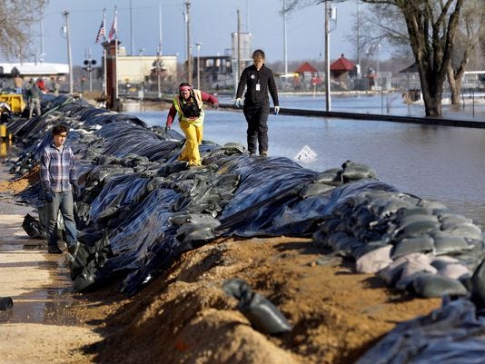
Many dams broke which led to even worst flooding and devastation throughout most of the Mid-West. This made for some concern for the people who lived down stream of all of this flooding. Many people where already taking precautions and building barriers to attempt in holding back the rising waters. This picture below is just one of the many sandbag walls created. This picture is courtesy of Fox News this photo is from June 15, 2008 in Iowa.

These floods brought massive destruction to nine states in the Heartland. 24 people died as a result of this flooding and over one hundred were injured. One positive thing was when FEMA took action, they were very efficient because the program had just been modified from the Hurricane Katrina disaster. If only they could get some of that rain now.

If you are thinking to yourself, "Man these 100 year floods are seeming to come more often!". You are not alone! Many scientists have been asking this same question. My parting thoughts for you are do you think that man is trying to control mother nature? Or do you think a changing climate is at fault? Or could it be a little of both??

Monday, November 11, 2013

Myth: Ring Around the Moon

Myth: Ring around the moon means that snow or rain will be on its way.

Result: This myth is mostly true.

The Science: The ring around the moon, like the one you see above, is formed by the moonlight shining through very small water droplets or ice crystals located very high in the troposphere. These very small water droplets and ice crystals are usually associated with cirrus clouds. Cirrus clouds are very thin, high clouds. These high, thin clouds can be located out in front of an approaching storm system. While this is not 100% true I can say, the brighter the halo around the moon, the greater the chance of precipitation. So next time the moon is out, look up and see if you can see the halo!

Happy Monday Everyone!!


Photo From:
home.hiwaay.net

Tuesday, October 15, 2013

Forecasting 101: Climate vs Weather

Since the term "Global Warming" is such a hot topic not only in the science world but now is becoming a term used in every day life. I wanted to specify what "Global Warming" is referring to.

Firstly, the term Weather is the state of the atmosphere at a specific place and time. For example, it is 50 degrees outside my house right now with overcast skies. That is the weather. Meteorologists can forecast "Weather" from a Nowcast which is the weather forecast for the next 3-7 hours to long range forecast which is about a 14 day forecast.

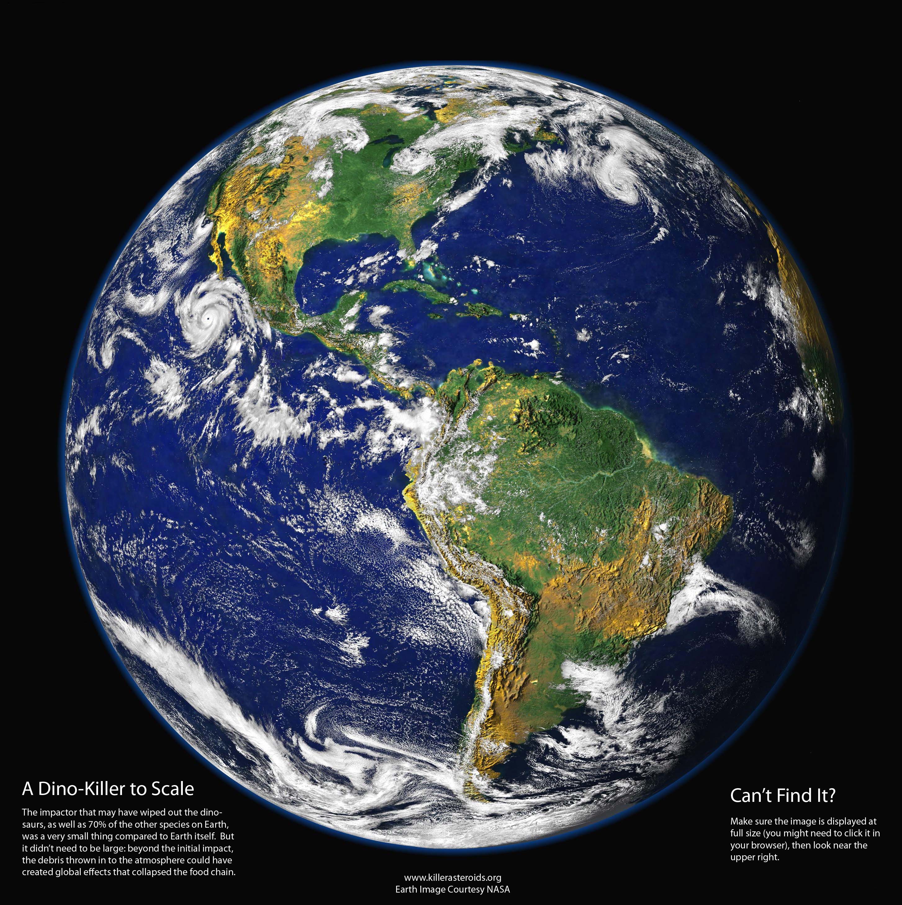
After about 14 days the state of the atmosphere becomes hard to predict for a specific place and time so, you generalize, this generalization or averaging is called predicting the Climate. Climate, is an average of weather over a long period of time. For example, when the Dinosaurs roamed, the Earth's climate was very warm. My main point is Climate is an average of the weather that is occurring over a long period of time.

This brings me back to the term "Global Warming", which was first talked about in the 1970's. Global Warming means that in a climate has been increasing in temperature for the past 15-20 years. This means that every place in the world that people are recording temperature data is averaged together to make a plot which shows the global temperature rising over the past several years. That is what the term "Global Warming" means. I'm not going to fight anyone about the specifics on the how's, what's, and why's about Global Warming. I just want to make it clear that "Global Warming" is a CLIMATE term not at weather one.

It's one of my pet peeves when people say it's "Global Warming" when its a hot summer time day in July. Um, hello! It's suppose to be hot in July people, well if you live in the Northern Hemisphere at least. And just because it's hot where you are, which is weather by the way, doesn't mean that it's hot somewhere else.

I'm not saying that the world is or isn't warming I just want to make sure people are using the correct terminology when they speak about it. Short but sweet lesson on Weather and Climate! If you have any questions about the definitions on either of the subjects feel free to ask.

Photo From:
killerasteroids.org

Wednesday, July 31, 2013

Wacky Weather: Dust Storm and Hurricanes

Whoa didn't think you would hear those two words in the same title did you? A large dust storm just came off the North African coast and looks like it may hinder hurricane formation for the first part of August.

A combination of dry air and dust will both cool the ocean and lower moisture levels over the Atlantic Ocean. Now when I say cool I don't mean the ice age is coming. It will only cool about 1°C but in ocean terms this is very significant. 

As meteorologist enthusiast you must have thought the same thing I did when I first heard this, wouldn't this enhance cloud formation? When I took Atmospheric Physics, it was taught by a cloud physicist, who told me dust and salt particles can be the basis of cloud formation. However after further research about my inquiry, I found that more low-level clouds will cool the sea surface as well, which would not aid hurricane formation.

Photo/Idea From:
WashingtonPost.com
wunderground.com

Monday, July 8, 2013

La Grande Weather Service

Just thought I would take a break from weather facts and tell you a little more about myself. I am currently a forecaster at La Grande Weather Service. I dabble in a little bit of everything with them. In the winter, I forecast for Anthony Lakes Ski Area, and now in the summer time I am forecasting fire weather for Northeastern Oregon.

This weather service is based in La Grande, Oregon. They provide various types of forecasts for the residents of Northeast Oregon. Their goal is to supply the rural communities of Northeast Oregon with accurate weather forecasts. This is critical especially in the summer months with the dangers of wild fires. This is why the company has just developed a new fire weather model to help them in forecasting the fire dangers in Northeast Oregon. Check out this new model or LGWS forecasts at the LaGrandeWeatherService.com or email the Meteorologist in Charge, for more info.


Wednesday, June 26, 2013

Lightning Safety Awareness Week!

I'm sure you have heard this before... When you hear or see lightning, seek shelter immediately. Lightning is not something to mess around with. One strike of lightning has enough power to run a light bulb for a year. And on top of how much power it generates form one strike, lightning is 50,000 degrees Fahrenheit!  

I'll give you a small lesson on lightning. It all starts with a Cumulonimbus cloud (Thunderstorm cloud) has different charges within the cloud. There are protons or a positive charge at the top of the cloud. And there is electrons or a negative charge at the bottom of the cloud. Then the ground is mostly positively charged. The opposite charges within the cloud and on the ground creates lightning. This lightning will actually pass through a channel that was made through the air multiple times. Which is why you see multiple flashes of light sometimes. Lightning also looks for the shortest distance to the opposite charge which is why tall buildings and trees are struck by lightning more often then something lower to the ground.


Photo/ Info From:
nws.gov
britannica.com
theatlantic.com 

Wednesday, June 19, 2013

Wacky Weather: Tornado in Denver

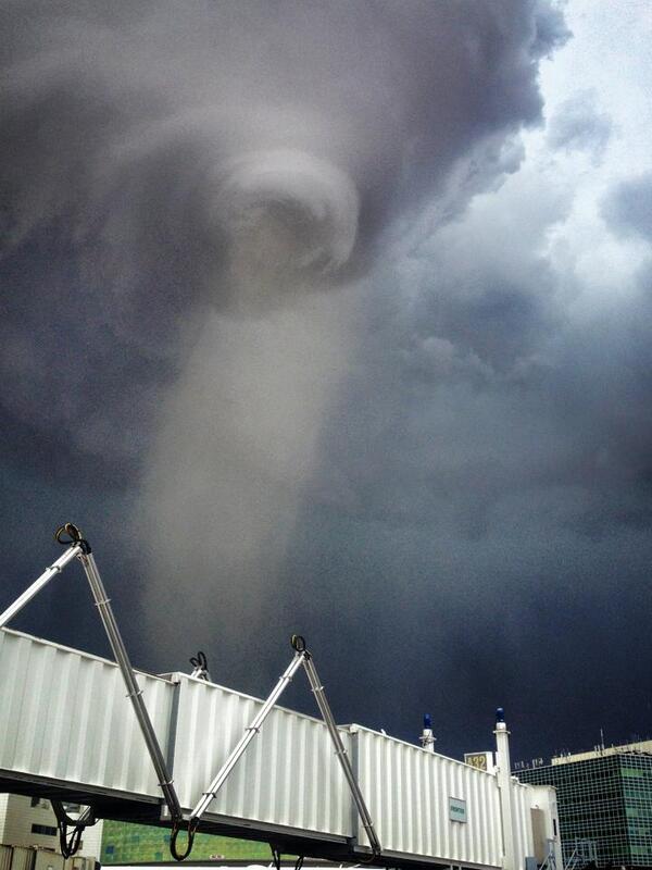
Airplanes weren't the only things to touched down at the Denver International Airport yesterday. An EF-1 tornado made its own flight plan to land at the airport as well. The tornado did directly hit some weather instruments at the airport, and luckily were not damaged. However, the instruments did record a gust of 97mph. No one was injured and no major damaged reported during this event.
View image on Twitter

Photo From/ Info From:
wunderground.com
7News Denver

Tuesday, June 18, 2013

Forecasting 101: Derechos

Some of you might have heard last week the meteorologists call the approaching storms Derechos. I figure that most of you have never heard this word in your life before, so I thought I would break it down for you.

A Derecho is a strong straight line wind event common associated with a "Bow Echo" or a line of thunderstorms. Now when I say strong winds, I am talking upwards of 100 mph gust. In last weeks derecho event there was a report of 91 mph gust in Fort Wayne, Indiana, and a report of 81 mph gust in Tuckerton, New Jersey. Last week's derecho was a "Super Derecho" Event, because of the widespread area that it covered.  Most Derecho events hit the southern plain states. In fact, the Mid Atlantic states see a derecho event about every four years.  Pictured below is the Derecho event from last week. As you can see the intense bow echo progressed over Virgina and through the DC area.


Photo/ Info From:
accuweather.com

Thursday, June 13, 2013

Throwback: April 3, 1974

The second largest tornado outbreak on record, The Super Outbreak. There was 148 confirmed tornadoes that touched down in almost 13 different states. The Super Outbreak caused over 300 causalities.
File:Super Outbreak Map.jpg
Above is a photo of all of the tornado tracks from that day. There were 7 confirmed F5 tornadoes.

Wednesday, June 12, 2013

Wacky Weather: Flooding in Europe

A blocking high pressure system in Northern Europe has sent low pressure after low pressure to southern Germany and Austria. These low pressures have dropped so much rain over central Europe that the Danube river in Germany has crested over it's banks and has reached a flood level that has not been reach since the 1500's. Talk about your one hundred year floods. Below is a picture of Danube river in Deggendorf, Germany from Friday the 7th.

So you may be thinking to yourself, "I feel like these "one hundred year floods happen all the time!". Well you aren't the only one thinking this, Scientist are calling it the "New Climate".

Picture and Info From:
wunderground.com

Wednesday, May 15, 2013

Wacky Weather: Slow Start To Tornado Season

My apologizes, I haven't written in a while because I was on vacation, went to Purdue University to watch my little sister graduate and have been quite busy with my job. Anywho, while I was away I noticed that my nice warm temperatures, which I was absolutely in love, with took a vacation as well!
http://enterprisesolutions.accuweather.com/assets/images/DA1_Tornado_1.jpg
Our quite normal spring, has led to a slow start to the tornado season across much of the country. In fact, there has only been 237 tornadoes confirmed since the first of the year, which is minimal compared to the 659 confirmed tornadoes last year to this date. However, this below normal trend is expected to end this weekend as much of the country is starting to warm up, due to a southeasterly flow.

Notice how I said "normal spring", this is true our temperature throughout most of this spring have been near normal. We just think that it's cooler than usual because of all of the warm springs we have had for the past couple of years.

And Happy Birthday to my Dad!! 

Picture and Info From:
Accuweather.com

Wednesday, May 1, 2013

Wacky Weather: Tropical Cyclone Zane taking aim for Australia.

As our counter parts in the southern hemisphere gear up for winter, it also means that it is prime time for their tropical cyclones season. In fact, Tropical Cyclone Zane is taking a aim at Australia's northeast coast. The Cape of York in Queensland is bracing for a strong tropical cyclone to hit Wednesday night (local time), with winds expected to be sustained at 100mph. Heavy rain is also expected with this system.

Photo From:
accuweather.com

Tuesday, April 30, 2013

Forecasting 101: Tornadoes and Severe Storms

With tornado season really starting to rev up, I thought that I would give you all a 101 on tornadoes. First of all a tornado is a rotating column of air that extends from the ground to the cloud.
 http://www.dvice.com/sites/dvice/files/dakota-prairie-tornado_127_990x742.jpg
Tornado is such a common word heard all around the United States, but believe it or not tornadoes occur almost every where around the world as well. In fact, New Zealand reports about 20 tornadoes per year.

Although it is not fully understood how tornadoes form, we do know that the most destructive tornadoes form within a rotating supercell thunderstorm. Basically, what I mean is that if thunderstorm is rotating, so there is a good chance that other things with in the thunderstorm are rotating as well.

Now when the Storm Prediction Center, SPC, issues a tornado watch, this means that the conditions are FAVORABLE for a supercell thunderstorm to form and possibly a tornado. When a tornado warning is issued this means that a tornado has either been sighted or indicated by radar or a funnel cloud has been sighted. When a tornado warning is issued for your area take cover immediately!!

So what can you do if you are outside with no radar... look to the clouds of course! I am going to show you two different clouds to look for the first is called a Wall Cloud, which is pictured below. The second picture below I took, it is also of a wall cloud, it is just not as well defined as the first one. If you see this get ready it's about to get nasty!
http://icons-ak.wunderground.com/data/wximagenew/s/skasner/0.jpg
photo.JPG

Another cloud that could mean that severe weather is on the way are called Mammatus clouds. While, you can see mammatus clouds without severe weather. If you know that there could be severe weather that day and you see these clouds, get ready for a nasty storm to roll on through. Remember also that these clouds can be seen after a storm as well! I also put one of my pictures that I took of some mammatus clouds.


Photo From:
dvice.com
wunderground.com
wiki.com

Monday, April 29, 2013

Myth: Wearing metal on your body attracts lightning.

Myth: Wearing metal on your body (jewelry, watches, glasses, backpacks, etc.), attracts lightning.
 
Answer: While metal is a conductor of electricity, wearing metal does not increase your chances of being struck by lightning.

The Science: Isolation, height and a pointy shape are the biggest factors when lightning finds the easiest path to the ground. So wearing jewelry virtually has no effect on whether you get struck by lightning. However, metal fences, bleachers and metal railings are probable not the best thing to be by when a lightning storm hits.  

Photo From:
psychoactif.blogspot.com

Wednesday, April 24, 2013

Wacky Weather: Flooding in the Plain States

A combination of a couple of big rain producing low pressure systems and snow melting has been causing many rivers in the MidWest to rise over there banks. In St. Louis, Missouri the Mississippi river is 10 to 12 feet above flood stage. If you are concerned about flooding in your area check out the Hydrological Prediction Center or you can visit NWS River Forecast site. 


Photo From:
usatoday.com

Monday, April 22, 2013

Myth: If Trapped Outside And Lightning Is About To Strike, I Should Lie Flat On The Ground

Myth: If Trapped Outside And Lightning Is About To Strike, I Should Lie Flat On The Ground.
 http://www.srh.noaa.gov/jetstream/lightning/images/golfgreen.jpg


Answer: Please don't! Continue moving to your shelter or crouch down.

The Science: When lightning strikes the ground the electric currents travels along the top of the ground, and the this electric current can be deadly over 100 feet away. Look at the picture above, this is picturing a ground lightning strike. While lying flat on the ground gets you as low as possible, it increases your chance of being hit by a ground current. The best thing if you cannot reach a shelter would be a combination of being low and touching the ground as little as possible. Meteorologist call this the 'lightning crouch': put your feet together, squat low, tuck your head, and cover your ears.

Photo/ Info From:
srh.noaa.gov

Wednesday, April 17, 2013

Wacky Weather: Third Spring/ Winter Storm On It's Way

Man spring is taking its sweet time warming the northern states up. This will be our third week in a row (in APRIL I might add) that we are talking about snow showers. And I am not sure if April snow showers will bring May flowers. However, I do know that "cold temperatures" records and "Snowiest Aprils" records are in jeopardy as we head in to next week. Last weeks storm brought 30" of snow in some areas of the upper MidWest, and this next storm should be just as intense. As far a cold temperatures, Fargo, North Dakota has yet to get above 50 degrees Fahrenheit this year, and doesn't look like Fargo will be getting out of the 40's till at least next week. Brrrr!!  I also found a comparison of what the snow depths are today and what they were a year ago.
 

Also remember spring time storms that bring snow to the north mean storm conditions down south. Look out for a tornado outbreak. 

Photo/ Info From:
wundergound.com

Monday, April 15, 2013

Myth: Open Your Windows When A Tornado Is Coming

Myth: Opening your windows when a tornado is coming will equalize the pressure in your house. If you do not open your windows, they will shatter from the intense pressure. 

Answer: This is quite false.

The Science: Although there are many forces at work when a tornado is formed, your windows would have to endure at least 100 to 200 mph winds surrounding the vortex of the tornado to experience the extreme low pressure of a tornado. With that being said, please keep your window close during a tornado threat. Tornadoes are know for throwing large debris that can be very dangerous like the piece of wood that is sticking out of the building above, so opening your window will only allow more debris to enter your home.

I hope everyone is having a lovely Monday!

Photo From:
stormchaser.ca

Wednesday, April 10, 2013

Wacky Weather: Spring Storm to Bring Alll Sorts of Weather

This strong mid-April storm is bring all kinds of weather across the lower 48. Moving slowly across the country, this storm is producing tornadoes to the south and heavy snow to the north. Below is a forecast map from the National Weather Service. And this storm is going to be moving to the east as the week ends.
Weather Forecast for the Morning Issuance of April 10, 2013

Tuesday, April 9, 2013

Forecasting 101: Wind Chill

Wind Chill is basically an equation that combines the actual temperature and wind speed. Why do we care about Wind Chill, well because the faster the wind blows the faster exposed areas of our body lose heat. Which means that frost bite and hypothermia could occur more quickly then if the winds were calm.
 
Wind Chill is usually calculated with this chart provided by the National Weather Service. Wind Chill is usually given in a range because first you have to predict the temperature for the forecast time and then predict how fast the wind will be blowing. 

Hope you have fun using this chart next time it gets cold and windy!!


Photo/Info From:
noaa.gov
meted.ucar.edu

Originally published on Jan. 15th, 2013

Monday, April 8, 2013

Myth: Manure Piles Smell Stronger Just Before It Rains

Myth: Ditches and manure piles have a more potent smell just before it rains.
http://www.gardeningknowhow.com/wp-content/uploads/2011/01/compost-sign-300x225.jpg
Answer: Yes, they do in fact!

The Science: Believe it or not, a foul smell in the air can be an inkling of whether precipitation is in the near future or not. Does it smell like compost? Or does a manure pile smell more than it usually does? When a storm system is approaching, plants will release their waste which can make it smell like compost. Swamps will also release gasses, in loom of an approaching storm, which can lead to unpleasant smells. Plants, swamps, and manure piles do this because of the pressure drop from the approaching storm.


Photo From:
gardeningknowhow.com

Friday, April 5, 2013

Friday: Get Ready It Is The 17th Year

That's right it's the Cicadas! The offspring of the cicadas seen when Bill Clinton was president will be emerging from the ground this spring and summer. Although they don't affect the weather, they will be affecting our day to day activity. I was looking forward to the warm weather but now that I know that these guys will come with it... I'll take back any mean things I said about the cold weather.
Cicada exoskeletons clustered around a tree.
Once the temperature get consistently above 64 degrees Fahrenheit, the cicadas will start to emerge from the ground. States who will see as many as 1 million cicadas per square mile include: Connecticut, Maryland, North Carolina, New Jersey, New York, Pennsylvania, Virginia, and Washington, D.C. Although cicadas are concentrated in the East other areas of the country can see these huge bugs as well. So in other words get prepared for the humming and buzzing the 17 year Locust is coming this year. I found this site, cicadamania.com, was super helpful in protecting young shrubs and such.

Photo From:
nationalgeographic.com

Thursday, April 4, 2013

Throwback: April Fool's Blizzard

This April Fool's Day we all enjoyed opening day of Baseball, however, sixteen years ago in 1997 a late-season snowstorm dropped three feet of snow in some place along the eastern seaboard. Due to the date that the storm fell on people took the warnings less seriously, because they thought is was a prank. Many called it a "Mother Natures April Fool's Joke". Also because the snow storm was so late in the season most of the plows were stored for the summer and shovels were put back into storage. Despite the late of readiness from the public there were only four storm related deaths, three of which were heart attacks from shoveling. Below is Fenway Park in Boston, buried in 24 inches of snow. I also put a figure from the National Weather Service that shows who got the most snow from this storm.

File:Aprilfoolsdayblizzardtotalmap.jpg

Photo From:
noaa.gov
wcvb.com
politico.com

Wednesday, April 3, 2013

Wacky Weather: Dust From China Reaches California

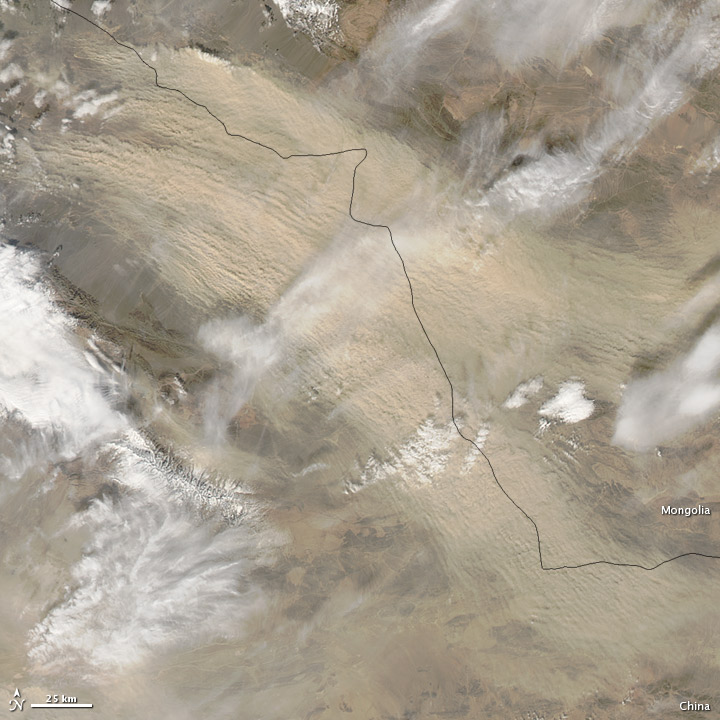
Dust from China's Gobi Desert has drifted thousands of miles across the Pacific Ocean to central California. The harsh dust storm that occurred in China on March 10th and created dangerously high pollution levels in Eastern China. You can see the dust storm from the NASA Satellite, note the sweeping light brown color, that is the dust. About ten days later the Air Pollution Control District reported some dust in the Owens Valley, which is just east of the Sierra Nevada mountain range.
http://eoimages.gsfc.nasa.gov/images/imagerecords/80000/80609/mongolia_amo_2013067.jpg

Photo and Info From:
nasa.gov
nbcnews.com

Tuesday, April 2, 2013

Forecasting 101: Fronts

The boundary between two air masses is called a front. (If you missed last weeks air masses forecasting 101 click on the link.) Today I am going to cover three of the basic types of surface fronts that occur, which include Cold Fronts, Warm Fronts, and Stationary Fronts.

Cold Fronts
A Cold Front is when cooler air is advancing into an area with warm air. Cold fronts are denoted by a blue line with triangles on it. Cold fronts can cause thunderstorms and rain to form at or around the front. The photo below is a cross section view of what is happening at the surface when a cold front is moving into warmer air.
http://yourweatherblog.com/wp-content/uploads/2010/12/101216-wiki-thundersnow021.png
Below is a photo of what a typical cold front would look like if your weatherman was show it on television. 


Warm Fronts
A Warm Front is when warm air is advancing towards an air who's current temperatures are cooler.  A warm front is represented by a red line with half circles. Fun fact, all of the fronts will point in the direction that they are moving. Look at the picture above see how the blue triangles are pointed to the east, well that is the direction the front is moving.  Anyway a warm front can also produce showers and storms at its boundary. I found a cross section of a warm front advancing into cooler air, take a look below.
http://www.rossway.net/warmfr.GIF

Stationary Fronts
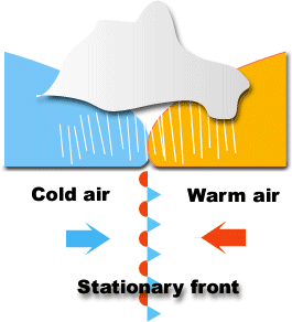
The last type of front I am going to cover is called a Stationary Front. A stationary front occurs when the boundary of a cool and warm air mass isn't moving in on direction or another, therefore it is "stationary". I found a picture the perfectly describes what is occurring. Also a stationary front is denoted by an alternating warm front and cold front symbol, represented below. Precipitation is often found at this type of air mass boundary as well.
http://www.sir-ray.com/front_stationary_en.gif 

These are your main fronts that occur most often. Maybe I'll cover some of the special types of fronts later. 


Photos From:
blogs.wdtn.com
yourweatherblog.com 
rossway.net
sir-ray.com

Monday, April 1, 2013

Myth: If March comes in like a lamb, it will go out like a lion.

Myth: If March comes in like a lamb, it will go out like a lion. This basically means that if there are harsh temperatures and bad weather in the beginning of March, then by the end of the month things should be better. 
http://www.schools.msd.k12.or.us/newby/images/Holiday%20images/March/March.JPG 

Answer: There is not a sufficient amount of evidence to say this myth is true.  

The Science: March has such variable weather, from snow storms to 70 degree weather, that makes it hard to put the data behind the truth of this myth. The ever changing weather of March is what holds this myth true in some years and not in others. Basically, it is just the luck of the draw. This myth is simply more of a rhyme then fact.     

Photo From:
schools.msd.k12.or.us

Thursday, March 28, 2013

Throwback: Lituya Bay Tsunami/ Get Tsunami Ready

Now I know that you all are thinking, that you will probably never see a tsunami in your life time, so why should you know this information. Well, the answer is... when you are playing trivia this random information will totally come in handy! I love trivia! But seriously, wouldn't you rather be prepared than not.

NOAA, the National Oceanic and Atmospheric Association, monitors buoys in the ocean that measure seismic activity. Underwater earthquakes are one of the big causes of tsunamis, and when detected by the buoys, warnings can be administered to the public faster. The faster the warnings are sounded, the faster people can get to safety. The safest place from a tsunami is inland, higher ground, or in a high building.

Remember tsunamis can also happen if a landslide causes a large amount of earth into a body of water. This actually happen in Lituya Bay, Alaska. In 1958, a earthquake caused a landslide of 30 million cubic meters to fall into the bay, this caused a huge tsunami that went 1720 feet up the opposing slope of the bay. While this kind of tsunami is rare, it is actually more dangerous and destructive then earthquake cause tsunamis. Below is a picture of Lituya Bay, where you can see all of the brown marks is where the tsunami hit.


This is just a reminder that tsunamis can happen anywhere so just be on alert! Happy Thursday everyone!

Photo From:
glogster.com

Wednesday, March 27, 2013

Wacky Weather: Earthquake in Mexico

Alright so earthquakes aren't exactly meteorology but they are still an earth science, and to be quite honest it was either talk about an earthquake or complain how it's not anywhere near warm! I thought that I wouldn't be a Debbie Downer and would focus on an Earthquake. In Santiago Pinotepa Nacional, Mexico a 5.5 magnitude earthquake shook most of southern Mexico.

http://www.lonelyplanet.com/maps/north-america/mexico/map_of_mexico.jpg
The epicenter was in Santiago Pinotepa Nacional which is about 200 miles from Mexico City, near Acapulco on the map above. There hasn't been any reports of injuries, but people said that buildings in Mexico City were shaking. 

Photo From:
lonelyplanet.com

Tuesday, March 26, 2013

Forecasting 101: Air Masses

An Air Mass is a large body of air in which the properties are the same in a horizontal direction. Air masses are determined by their temperature and moisture content. There are three different temperature categories for air masses: Arctic (A), Polar (P), and Tropical (T). The three different temperature categories are then paired with either a Continental (c) or a Maritime (m) to represent what moisture that particular air mass holds. Continental is a dry air mass while Maritime is a moist humid air mass. The type of air mass can usually be determined by where the air mass is coming from. For example look at the figure below from one of my text books. Note that most of the time Arctic air will not be associated with Maritime air. This is because Arctic air is so cold it can't not enough moisture to be considered Maritime.

 Air masses are important to pay attention to when forecasting because they usually hint to what what the weather is going to be moving in. I wanted to go over air masses because next week I am going to talk about the boundaries of air masses or what are commonly called Fronts! Yayyy! Get excited!!


Photo From:
geospatial.gsu.edu

Monday, March 25, 2013

Myth: Tsunamis are One Big Giant Wave

Myth: Tsunamis are one big giant wave.

In honor of this week being National Tsunami preparedness week!! I thought I would do a myth buster for your lovely Monday morning!
http://baghdadbythebaysf.com/wp-content/uploads/2011/12/karachitsunmai.jpg

Answer: No way! The picture above is not real!

The Science:  A tsunami is a series of low, fast and long ocean waves that can be caused by and earthquake or a sudden displacement of water. And most of the time the wave moves in all directions. Basically, just think of a tsunami as a wave that keeps on coming, not a huge tall wave. It's like a flood from the ocean or bay. I know that's not very scientific, but it is the only way I can think to explain it. The picture below is an actual picture from Japan.


Info/Picture:
baghdadbythebaysf.com
telegraph.co.uk

Thursday, March 21, 2013

Throwback: Hurricane Irene

In late August of 2011, Hurricane Irene formed in the middle of the Atlantic Ocean. It first made landfall in the Bahamas, then took a turn to the north.  Hurricane Irene weakened to a Category 1 hurricane before striking the North Carolina coastline with sustained winds at 85mph. It then continued northward skirted along the Jersey Shore and completely made landfall over Brooklyn, NY. Below is a track of Hurricane Irene.

As Hurricane Irene continued northward into New England, it continued to reek havoc. Strong winds and heavy rainfall devastated Vermont and New Hampshire.  Total storm damage cost 15.6 billion dollars, which makes Irene the 7th costliest hurricane. The cover bridge below is just one of many that were destroyed because of Hurricane Irene, and most of these bridges were over 100 years old.


To check out more Hurricanes that have hit the East Coast check out my earlier blog post, East Cost Hurricanes Through the years.


Photo and Info From
noaa.gov
vtdigger.com

Wednesday, March 20, 2013

Wacky Weather: Late Season Snow Storms

Happy First Day of Spring!!! Although, most of us still feeling a winter chill. In meteorology talk, there is a blocking High Pressures system in Canada keeping the Jet Stream south giving the MidWest and East a very active and cool weather pattern. Unfortunately, for you looking for spring, this pattern looks to persist into the first week of April. I found a graphic from AccuWeather that perfectly describes what I am trying to say.

The most recent winter storm hit the northeast yesterday, dropping anywhere from 1 to 6 inches of snow from Philadelphia to New York.  And models are hinting to yet another late snow storm for the MidWest and East next week! Get ready, winter is not over yet! (even though I wish it was)


Photo From:
accuweather.com

Tuesday, March 19, 2013

Forecasting 101: Flooding Types

As Meteorologist, one must look at several factors in order to decipher whether some sort of flooding is possible. Remember, it doesn't always have to rain in your backyard for it to flood. 
http://kwtv.images.worldnow.com/images/7515388_BG1.jpg
There are various reasons that flood can occur under, for example; multiple days of rain, snow melt, poor drainage. However, to break it down there are three main types of flooding.

1. Is your A-typical Basic Flood, which is commonly called "river flooding". This type of flood is caused by an overflowing river or some similar body of water that last for an extended amount of time, usually greater than 12 hours. This type of flooding is generally due to an excessive amount of rain over a couple of days. However, snow melt can be another cause.

2. Flash Flooding, is when an area receives an excessive amount of rain in a short time. This type of flooding can cause poor drainage areas to flood very suddenly. A big cause to flash flooding can also be leaves or clog drains, because there is no where for the water to drain in piles up and floods. Flash Flooding is probably the most severe kind of flooding because it can happen so quickly and catch people off guard.

3. Coastal Flooding, occurs when strong onshore winds push water from an ocean, bay or inlet onto land. This type of flooding can form from storm surges associated with tropical storms and hurricanes, or can be associated with non-tropical storms such as "nor'easters".


Info/ Picture From:
Noaa.gov
weather.com
news9.com

Monday, March 18, 2013

Flood Safety Awareness Week

Thought I would inform you all that it is Flood Safety Awareness Week. It floods somewhere in the United States or its territories nearly every day of the year. Flood waters have caused about 8 billion dollars in damage in the past 30 years as well as claiming about 100 lives per year. That is more then hurricanes and tornadoes! Being prepared in advance and knowing a few flood safety tips will help you and your family survive a flood if it happens in your area.

Know your risk! Ask yourself, Do you live in a flood prone area? If you are not sure contact your local National Weather Service office and find out. Knowing this information is very important!

Do you live by a river? If so it might be a good idea to visit and maybe even book mark the Advanced Hydrologic Prediction Service (AHPS). This service forecast how high the flood waters will be across the United States.

The most important thing I can tell you is if a road way is covered by water, DO NOT TRY TO GO THROUGH! Driving is actually the biggest killer when it comes to Flood Waters.
flooded road with Turn Around Don't Drown sign


These are just a few tips to help you prepare for a flood. For more information, please visit The Flood Safety Awareness website at
www.floodsafety.noaa.gov

Knowing your flood risk, how to prepare for and actions to take before, during, and after a flood can save you time, money, and even your life. 


Photo and Info From:
Noaa.gov

Thursday, March 14, 2013

Throwback: Tohoku Earthquake and Tsunami

Monday marked the two year anniversary of the Tohoku earthquake and tsunami. March 11th, 2011 Japan experienced a 9 magnitude earthquake. This massive earthquake then sparked a tsunami which hit the Japanese coast just minutes after the earthquake. Survivors said that they wave reached about 23 feet in height. Unfortunately, 2994 lives were claimed during this event and over 6000 people were injured. Japan is still suffering from the effects of this event. In fact, according the Japanese Government over 300,000 are still homeless due to the event.

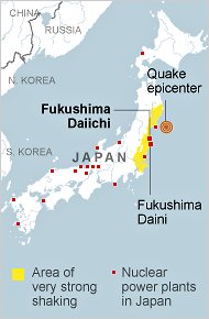
One of the biggest worries from this disaster was the fact that there were several Nuclear Plants in danger from the tsunami waves. Below is a map of Japan and where all of the Nuclear Plants are located. The experts claim that the radiation that was leaked at Fukushima was non life threatening.

http://www.nonukesyall.org/images/Japan_nuclear_map.jpg
Photo/Info From:
freeandhandy.com
planetearthandhumanity.blogspot.com
ouramazingplanet.com
forbes.com
hiroshimasyndrome.com